Field guide / Destination selection
Choose stops that fit the road day.
Iceland’s winter destinations range from coastal viewpoints and settlements to waterfalls, volcanic landscapes and geothermal regions. The practical question is not only what a place offers. Consider the approach road, daylight available, time on foot, weather exposure, parking and the return journey. A short list of suitable stops is more useful than a packed map.
Use named places as planning references, then check current access, restrictions and conditions through relevant local information. This guide does not confirm opening hours, road access, facilities or safety at any site. Conditions may change after a plan is made.
Destination types and trade-offs
| Type | Planning value | Winter consideration |
|---|---|---|
| Coastal scenery | Wide views and settlement links. | Wind, spray and exposed stops can affect comfort and access. |
| Waterfall areas | Strong visual interest and short-viewing options at some sites. | Ice, slippery paths and site-specific restrictions need attention. |
| Volcanic terrain | Distinct geology and broad landscape context. | Do not leave permitted areas or assume paths are suitable. |
| Geothermal regions | Visible heat-related landscape features. | Stay on marked routes and follow posted safety information. |
| Small settlements | Useful planning anchors and services where available. | Check opening status; do not assume facilities are operating. |
Coastal destinations
The south coast connects settlements with waterfalls, coastal features and black-sand areas. Recognizable locations include Seljalandsfoss, Skógafoss and the Reynisfjara area near Vík. These are planning references, not a promise of winter access or safe conditions. Waves, weather, wind, icy surfaces and posted site guidance can change what is appropriate. Follow barriers and local safety instructions; never approach the water or unstable edges for a photograph.
Further west, the Snæfellsnes Peninsula offers coastlines, mountain views and small communities within a varied regional circuit. The route can feel compact on a map, but conditions, daylight and stops may extend the day. Select a small number of priorities and identify a safe way to shorten the outing.
Waterfalls and winter surfaces
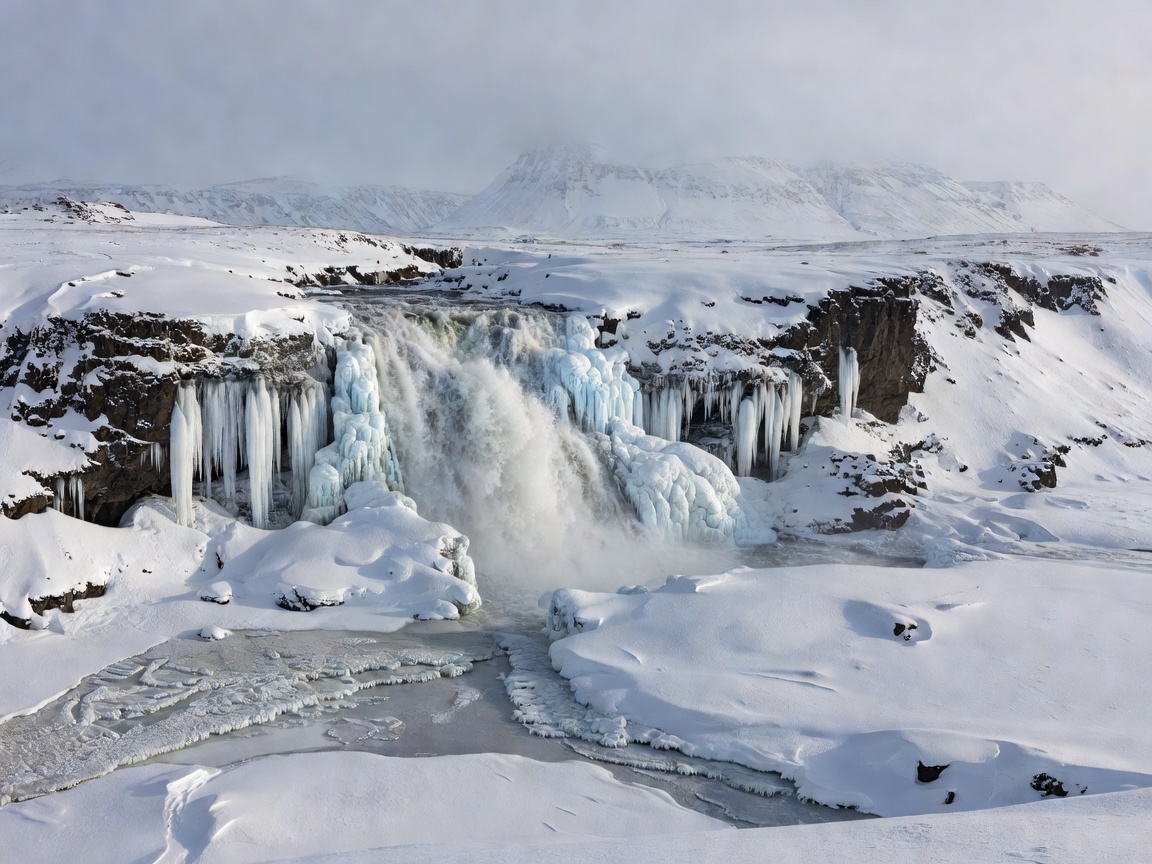
Waterfalls can draw visitors in cold weather, but the ground around them may be icy, wet or uneven. Use designated paths and viewing areas only when they are open and safe. Do not walk onto frozen water or leave a marked route. A photograph is never worth crossing a barrier or walking on uncertain ice. Build time for careful movement and for conditions that limit access.
Volcanic and geothermal landscapes
Volcanic terrain is part of the country’s landscape story, but not every visible area is an accessible visitor site. Use marked public access, current site guidance and established paths. Geothermal ground can present hazards that are not obvious from a photograph. Stay within permitted areas and heed signs. Do not rely on unofficial tracks or shortcuts.
For viewpoints, select legal stopping areas with safe access. Pulling onto an unsuitable shoulder can expose people and traffic to risk. If there is no safe place to stop, keep driving. Winter light can be brief, and visibility can change; a roadside image is optional, not a reason to take an unsafe stop.
Make destination choice fit the trip
Daylight: prioritize one region or a few nearby stops. Check sunrise and sunset for the travel date. Weather: a sheltered settlement visit may be a more suitable alternative to an exposed coast, but only current information can guide the decision. Road access: verify the approach and return route. Trip duration: allow time for breaks and slower movement. Driving experience: reduce distance when winter conditions are unfamiliar. Flexibility: keep a nearby alternative and be willing to skip both if conditions require it.
Photography without adding risk
Plan a photo stop at an established, safe viewpoint. Keep equipment accessible so a stop can be brief. Do not stand in the road, block traffic, cross barriers or walk onto unstable surfaces. Low winter sun, cloud and dark skies can change visibility quickly. Keep attention on the road when driving and stop only in a designated or otherwise safe, permitted place.
Good For
- Visitors choosing between coast, waterfall, volcanic and settlement stops.
- Drivers building a short, daylight-aware sightseeing list.
- Photographers who want safer viewpoint planning.
What To Know
- Named locations do not imply current access, opening hours or safe conditions.
- Check site-specific restrictions and local information before setting out.
- Do not cross barriers, approach dangerous water or walk on uncertain ice.
- Keep the return drive and changing weather in the day plan.
For route structure, see Iceland Winter Routes. For conditions and current-information checks, read Weather & Road Conditions. Questions and corrections can be sent through Contact.